Merchandise
Rieslingfeier + vom Boden Mosel Map
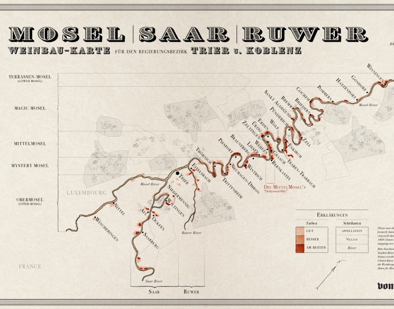
Rieslingfeier has partnered with vom Boden to release a new map of the Mosel based on the aesthetics of the famous 1868 and 1897 Prussian Tax masp (see above). The original art was drawn by Stephen Bitterolf and features many of the most important villages of the Mosel as well as a provocative five-section schematic, breaking down the Mosel into the Obermosel, Mystery Mosel, Middle Mosel, Magic Mosel and Terrassen-Mosel.
To our knowledge this is one of the first original Mosel map designs in many decades. For more on these maps please visit vomboden.com.
All maps are printed on 100lb archival cover stock. There are two formats available: a larger map measuring 20 x 32 inches and a smaller map measuring 18 x 24 inches. All prices include shipping within the continental U.S.; unfortunately we cannot ship outside of the continental U.S.
Please inquire as per wholesale orders: orders@rieslingfeier.com
Rieslingfeier + vom Boden Mosel Map
1868 Steuerrath Clotten Mosel Vineyard Map Reprint
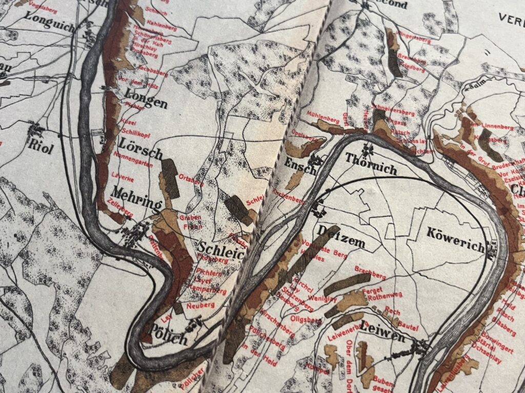
The Prussian government commissioned the Steuerrath Clotten Mosel vineyard map in 1868. This was a revolutionary document for the time, clearly articulating the idea of terroir with an unprecedented level of specificity. Eight tax levels, in fact, were simplified and condensed into three “quality” rankings for the vineyards, indicated by the three-tone legend toward the bottom-left of the map. Meanwhile, the celebrated contemporary Bordeaux classification (1855) ranked quality based solely on the producer, with no mention of the vineyard at all.
Reprint of the 1868 Steuerrath Clotten Mosel Map
Includes an important section of the Mosel, from Trier to Wolf, including the Saar and Ruwer tributaries.
55″ x 16″ | Buy the Steuerrath Clotten Map – $75
includes shipping anywhere in the U.S.
1868/1897 Regierungsbezirk Trier und Coblenz Mosel Map
1868/1897 Regierungsbezirk Trier und Coblenz Mosel Map Set
1868 Regierungsbezirk Trier und 1897 Coblenz Mosel Maps
39.5″ x 12″| Buy the Regierungsbezirk Map Set- $60
includes shipping anywhere in the U.S.
Save the Mosel T-Shirts

Published in The Art of Eating, 2010, No. 84


